A technician who has worked the Portland basin quickly learns that the difference between a smooth dig and a costly delay often comes down to how well you read the instrumentation before the first crack appears. The city's mix of alluvial silts, liquefiable sand lenses, and weathered basalt creates a layered subsurface where excavation behavior is rarely uniform. Monitoring goes beyond taking inclinometer readings; it means understanding how a shoring system interacts with saturated Missoula Flood deposits or how a dewatering pump is really affecting pore pressure two blocks away. When we deploy arrays of settlement points, piezometers, and tiltmeters across a site, we are building a continuous feedback loop that lets the contractor adjust bracing or ring sequences within hours, not days. This real-time interpretation is what separates a monitoring plan that checks boxes from one that actively prevents ground loss and utility damage in Portland's tight urban corridors. For deeper cuts where the CPT test has already mapped a continuous soft layer, the monitoring thresholds become even tighter.
Ground movement in Portland silts often accelerates after dewatering starts, not during excavation — the lag effect catches many off guard.
Service characteristics in Portland Oregon
Local geotechnical conditions in Portland Oregon
The risk profile diverges sharply between a site in the Pearl District and one up on the West Hills. In the Pearl, excavations punch through historic fill and river-deposited silts that lose strength rapidly when dewatering gradients reverse; a monitoring plan there must prioritize piezometric response and adjacent building tilt with hourly checks during the first week of pumping. Up on the basalt ridges, the hazard shifts to wedge failure along clay-filled joints, where an inclinometer casing installed too shallow will miss the creeping block entirely. The common mistake is treating the monitoring plan as a static document. In Portland, where winter rains can raise the water table by two meters in a single storm cycle, the alert thresholds set in August are often irrelevant by November. Ignoring this seasonal reset means the first real warning arrives as a crack in a sidewalk 30 meters from the cut, well past the point of easy mitigation.
Our services
Our instrumentation approach treats each site as a temporary laboratory, where the data stream directly informs the construction sequence. The two core service modules are designed to overlap, so that surface movement and subsurface pressure are never analyzed in isolation.
Real-Time Geostructural Monitoring
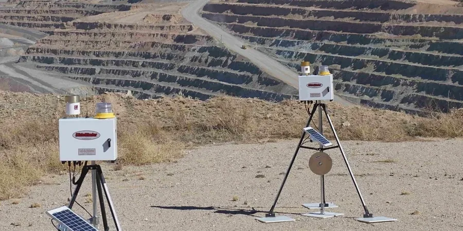
Automated total station networks, tiltmeter arrays, and crack gauges deployed across shoring walls and adjacent structures. Data is streamed to a cloud dashboard with SMS alerting when movement exceeds 80% of the IBC-defined threshold. This system is calibrated against a baseline survey conducted before any heavy equipment mobilizes.
Pore Pressure and Groundwater Monitoring
Multi-level vibrating wire piezometer strings installed in dedicated boreholes outside the excavation footprint. Readings are correlated with dewatering pump logs and precipitation data from the HYDRA network to distinguish between seasonal recharge and a developing sand boil condition in the subgrade.
Common questions
What does a geotechnical excavation monitoring program in Portland typically cost?
For a standard 4- to 6-month monitoring period on a single-level basement excavation in Portland, the instrumentation package and data reporting usually range between US$740 and US$2,260 per month, depending on the number of inclinometer casings, piezometer strings, and the density of optical survey points required by the geotechnical engineer of record.
How often should inclinometer readings be taken during active excavation near Portland's older masonry buildings?
We recommend daily inclinometer traverses within 15 meters of unreinforced masonry structures during active digging and tieback stressing. Once the final subgrade is reached and the base slab is poured, the frequency can step down to every 48 hours for the first week, then weekly if movement vectors stabilize below 0.01 inches per reading increment.
Which instrumentation is mandatory when excavating below the water table in the Portland basin?
At minimum, you need vibrating wire piezometers at two depths — one just above the excavation base and one 5 to 8 feet deeper — to detect upward gradients before they trigger a boil. Pair this with a settlement monitoring array extending at least twice the excavation depth beyond the shoring line. In layered silts, an inclinometer with a 0.5-meter reading interval is also essential to catch thin shear zones.