We’ve seen it too many times: a contractor sinks a backhoe into what the drawings called ‘competent soil’ and hits a buried paleochannel full of wet silt. Portland’s subsurface is a maze of Missoula Flood deposits, volcanic layers, and hidden groundwater pockets—traditional borings give you a pinprick view, but they miss what’s between the holes. That’s where electrical resistivity fills the gap. By measuring how easily current passes through the ground, our team builds a continuous profile of the subsurface across your entire Portland site. Before you finalize foundation depths or stormwater infiltration plans, a seismic refraction survey paired with resistivity gives you the layered picture that isolated SPT blows simply cannot provide.
A single resistivity line can replace three or four strategically placed boreholes when you need to map stratigraphic continuity across a Portland site.
Service characteristics in Portland Oregon
Local geotechnical conditions in Portland Oregon
Portland sits at roughly 50 feet above sea level on the Willamette River, but its geology is anything but uniform. Much of the metro area, especially east of the river and around the Columbia Slough, is underlain by up to 100 feet of unconsolidated silt and sand from the cataclysmic Missoula Floods. When these silts get saturated—common during our long rainy season from October to May—their electrical resistivity drops dramatically, creating a stark contrast with the denser Troutdale Formation gravels below. Without a VES survey, a foundation designed for uniform soil can end up bearing on a lens of saturated silt that nobody knew was there. The risk isn’t theoretical; differential settlement in these flood deposits has caused expensive remedial underpinning on projects from the Pearl District to Gresham. Resistivity mapping spots these transitions before the first yard of concrete is poured.
Our services
Every Portland project we take on starts with a clear question: what’s really down there? Our resistivity services are built to answer that efficiently, without blowing your pre-construction budget.
2D Electrical Resistivity Tomography
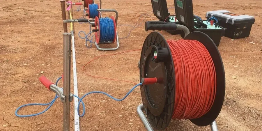
Ideal for linear infrastructure, slope stability investigations in the West Hills, or mapping the depth to the Troutdale gravels across a proposed building pad. We run multiple electrode arrays and invert the data to produce a color-contoured cross-section showing resistivity variation with depth.
Vertical Electrical Sounding (VES)
A fast, cost-effective method for estimating layer thickness and groundwater depth at a single point. We commonly use VES on smaller Portland lots where a full 2D line isn’t practical, or to calibrate borehole data when the drill rig can’t access tight backyards in neighborhoods like Sellwood or Alberta.
Common questions
How much does a resistivity survey cost for a typical residential lot in Portland?
For a standard city lot with a VES sounding and a short 2D profile, fees generally run from $580 to $930 depending on surface access, clearing requirements, and whether we need to combine it with other geophysical methods.
Can resistivity tell the difference between the Troutdale Formation and the overlying flood deposits?
Absolutely. The Troutdale Formation’s cemented gravels and conglomerates typically show resistivity values above 100 ohm-m, while the saturated Missoula Flood silts and sands read between 15 and 40 ohm-m. The contrast is strong enough that we can map the contact reliably across most of the Portland basin.
How does Portland’s wet weather affect survey results?
Rain actually improves electrical coupling with the ground and reduces contact resistance at the electrodes, which often yields better data quality. Our crew works through the rainy season; we schedule around the heaviest downpours for safety, but damp soil conditions are generally an advantage for resistivity work.